Hello!
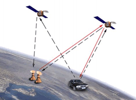
Since the 90s I have been observing how the world has been changing due to GPS technology. If at first it was mostly used for military and industrial purposes, by 2012-13 years, this technology came into our lives fully and ubiquitously – we have been using maps on a daily basis for a long time already: for car navigation, restaurant search, shopping, appointments, etc.
Almost all infrastructure and transport industry in some ways relies on GPS technology.
Interestingly, the core technology is relatively inexpensive nowadays, while maps, content and services that are based on it are considerably more expensive.
They have become the most valuable assets of the company.
After the success of Google Maps, Apple, Baidu and others began to develop and implement their own maps.
Nevertheless, GPS has two major drawbacks – not very high level of precision (an error is around 6 meters) and the inability to work in enclosed spaces.
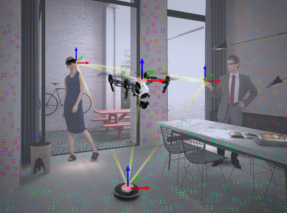
That is why the GPS-based maps cannot be used for navigation during the next wave of revolutionary devices that in 2-3 years will enter our daily lives – drones, home robots and AR / VR glasses.
What kind of sensors and technologies can replace GPS satellites and ensure the accuracy of 1-2 centimeters indoor and outdoor?
As strange as it may sound, but good old cameras (including stereo cameras) and Lidar can be handy. Lidars and stereo cameras began to grow “smarter” due to SLAM(Simultaneous Localisation and Mapping) technology and cheaper from 2011.
Even now it is possible to create maps with the accuracy of 1-2 centimeters and provide autonomous behavior of drones and robots using SLAM.
Creating a floor plan using a camera (in Augmented Pixels office):
Using a floor plan for an autonomous drone flight (in Augmented Pixels office):
What will happen next and how will these technologies and sensors develop?
We are on the verge of the release in 2018-2019 of radically new phones, simple and intuitive for end users AR glasses, household robots and drones.
All these devices will be equipped with new sensors (i think in 99% cases with stereo cameras) and SLAM to provide indoor navigation and autonomy functions.
Each device will create 3D SLAM map of the premises in which it is used.
The spread of such devices will help to create and maintain indoor and outdoor maps with minimal effort using crowdsourcing.
The next step after the maps are created is to merge them together and introduce to global users similarly to Google Maps; also they should be used during a human-drone/robot interaction.
Just imagine that thanks to 3D SLAM cloud maps a man with a mobile phone and AR glasses will be able to interact with other people with mobile phones/AR Glasses and robots in real time in the same coordinate system.
This opens up great prospects for improvement of current patterns of behavior (indoor navigation, etc.) and for creation of fundamentally new services, patterns of behavior and accumulation of fundamentally new knowledge, which will exceed the value of Google Maps in many times!
I hope that this article was helpful to you!
Inside of Augmented Pixels we have very interesting demos related with this topic, including a proprietary SLAM and cloud infrastructure — plz contact me directly in case of interest!
Sincerely,
CEO and Founder of Augmented Pixels
Vitaliy Goncharuk